Find us
The Department of Human Geography is located in the Geo-Science Building ("Geovetenskapens hus") – in the northern part of the Frescati campus, in the Royal National City Park, on Northern Djurgården in the City of Stockholm, Sweden.
Coordinates
WGS 84 (lat, lon): N 59° 21.947', E 18° 3.416'
WGS 84 decimal (lat, lon): 59.36579, 18.05693
RT90: 6584950, 1628031
SWEREF99: 6584773, 673722
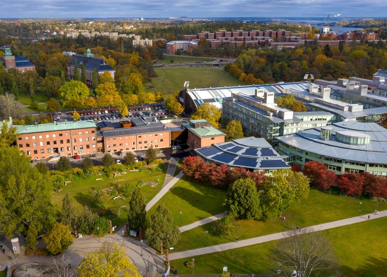
The main entrances (street addresses Svante Arrhenius väg 8, 12 and 14) are found at the south side of the building towards the field that stretches between the northern and southern parts of Frescati.
Directions
There are many ways to get to the Geo-Science Building. These are the most common.
Public transport
Many people get to the university by subway, but the campus can also be reached by Roslagsbanan and bus lines.
Metro
Choose red line (number 14) from Fruängen via T-Centralen towards Mörby center (or vice versa) to the station Universitetet. The journey takes 9 minutes from T-Centralen. Exit the station and continue straight ahead. The green Geo-Science Building is on the left side of the footpath. The distance from the station is approximately 120 meters (to the northeast).
Local train
Take the Roslagsbanan suburban train from Kårsta, Näsbypark, Österskär or Östra station (or another halt) to Universitetet. The Geo-Science Building is located approximately 300 meters east of the stop. Go up the bridge over the stop and continue to the right (east).
Bus
Buses that stop at Universitetet (near the metro station, 100 meters west of the house) or Universitetet norra (on Roslagsvägen, near the metro station) are: 50 (from, among others, Odenplan), 540 (Tensta center and Ulriksdal station), 608 (Vallentuna and Arninge), 639 (Rimbo), 670 (Vaxholm) and 676 (Norrtälje).
By bicycle or on foot
There are several cycling and walking routes to the campus, for example along Brunnsviken or Roslagsvägen or through Lill-Jansskogen.
Bicycle racks can be found outside the entrances to Svante Arrhenius väg 8, 12 and 14, i.e. at houses S, U and Y.
Stations for loan bikes are available at the Universitetet metro station and at Studenthuset.
Rented bus
The recommended place for boarding busses is at Svante Arrhenius road, next to Aktiverum (today "Frescati Sports Center", formerly "Frescatihallen"), just north of the Geo-Science building.
Taxi
Taxis can leave and pick up right outside the entrance at Svante Arrhenius väg 8 (house S).
Car
The campus can be reached via Roslagsvägen (from Roslagstull towards Norrtälje or vice versa), Frescativägen, Svante Arrhenius väg.
A limited number of paid parking spaces can be found on Svante Arrhenius road (south of Vegaplatsen at the National Museum of Natural History, next to Aktiverum, just north of the Geo-Science Building) and south of Södra huset. The smaller car park south of the Manne Siegbahnhusen is for university employees only – a special parking permit is required.
Charging stations for electric cars can be found in the car parks at Svante Arrhenius väg and Manne Siegbahnhusen, in the garage of the NPQ house and outside (Svante Arrhenius väg 16 F) and in the car park south of the Södra husen. In order to use the charging posts, you need – in addition to paying the parking fee – a sticker, which can be collected by students and employees at the service center at the Frescati library and on the Albano campus.
The campus is located within the area where congestion tax is levied for vehicles driving in and out of Stockholm's inner city.
Links to map services, visitor guide and more
Campus Frescati – Google Maps
Campus Frescati – OpenStreetMap
Campus Frescati – Stockholms stad
Find your way – campus and buildnings at Stockholm University
Stockholm visiting guide
Travel to Stockholm
By rail
The main railway station in the City of Stockholm is the Stockholm Central Station (“Stockholms centralstation” or “Stockholms central”). This is the station where all long distance trains stops in Stockholm. Located close by are the underground metro hub “T-Centralen”, the underground commuter rail station “Stockholm City”, the long distance bus terminal “Cityterminalen”, and a number of local bus stops. From the main railway station, the best option is to take the red metro line (number 14 bound for “Mörby centrum”) from “T-Centralen” to “Universitetet”, the metro station at the Frescati campus. Total travel time is about 15 minutes including 9 minutes by metro.
By air
The main airport is Stockholm Arlanda Airport. The airport is linked to the City of Stockholm by airport coaches (approximately every 10 minutes, 45 minutes travel to the coach terminal, "Cityterminalen", at the Stockholm main railway station), regular commuter train service (every 30 minutes, 38 minutes travel to the underground commuter train station, "Stockholm City", at the Stockholm main railway station), and a high speed train service (every 10-20 minutes, 20 minutes travel to the Stockholm main railway station).
The quickest public transport route from the Stockholm Arlanda Airport to the Frescati campus is the high speed train service “Arlanda express” from the airport to the Stockholm main railway station “Stockholms central”, and thereafter the red metro line (number 14 bound for “Mörby centrum”) to “Universitetet”, the metro station at the Frescati campus. Total travel time is approximately 45 minutes.
The second quickest (and presumably the less expensive) public transport route is the commuter train service (“Pendeltåg”) from the Stockholm Arlanda Airport (Note: Not departing from the same station as the high speed train.) towards “Södertälje centrum” to the “Ulriksdal” station, and then bus 540 (bus stop “Läge A” at “Ulriksdal”) to “Universitetet”. Total travel time is less than 60 minutes. Getting off the commuter train at the “Stockholm Odenplan” station and go by bus 50 (towards “Stora Lappkärsberget”) usually adds a few minutes; and the same goes for changing from commuter train to metro at the Stockholm main railway station.
The smaller airports in the greater region with regular passenger traffic are Bromma (20 minutes by airport coach and about 25 minutes by bus and commuter train or bus and metro to the Stockholm main railway station), Skavsta (80 minutes by airport coach) and Västerås (80 minutes by airport coach).
By car, coach and ferry
Stockholm is accessible. There are access to major road networks and ferry lines.
Getting around Stockholm (Stockholm Visitors Board)
Last updated: June 28, 2023
Source: Department of Human Geography